 I had looked over a number of California state road maps at a Barnes & Noble in Tracy. I was exploring a number of ways to get from Manteca to Paso Robles the long way. One map, and only one of the maps I looked at showed a sliver of a road that left Highway 198 just after Coalinga and headed south through Parkfield connecting with Highway 46. Naturally, this was the map I bought.
In Part VI, I had stopped at a BLM pull-out for a leg stretch and snap shots. From there, I headed west again on Highway 198, vigilant for a side road to my left that would take me to Parkfield and beyond. Sooner than I could blink, I spotted a side road with a small sign that read "Parkfield Grade." Well that had to be it so I turned left.
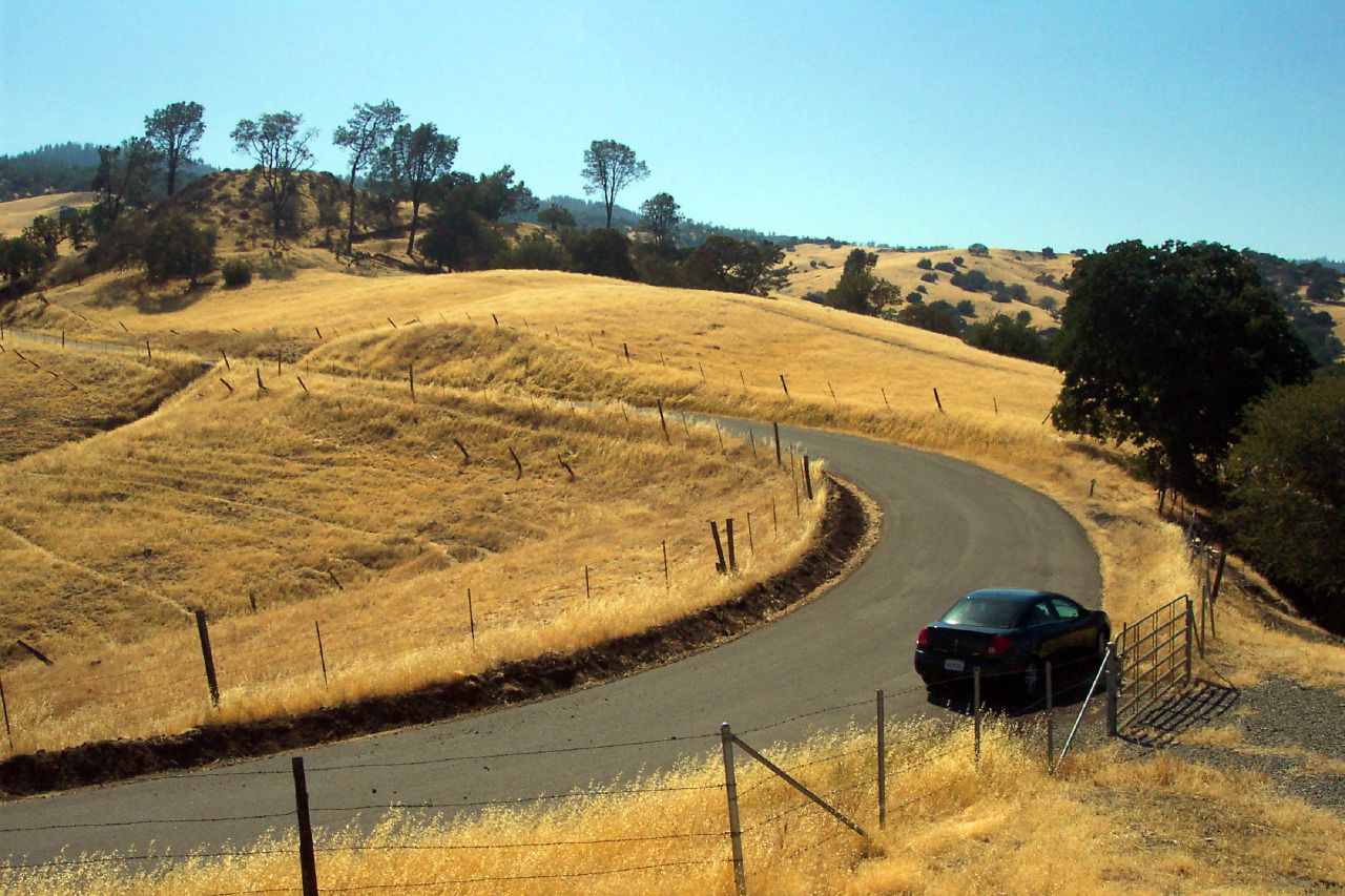
 The road traversed over a broad rolling oak-studded plateau, dipped into a couple dry washes, then began twisting and climbing up into the rounded ridges of the central California Coast Ranges. I found a pull-out on the narrow road that afforded a grand view of the plateau I had just crossed. I loved being here. This was the real California with all the sights, smells, and familiarity of growing up and tramping through the golden hills of California. This time of year, they were truly baked to a shimmering gold. Were this March, these hills would be emerald green, teeming with wildflowers and buzzing insects. On this day life slumbers here beneath the withering late summer sun and twisted live oak branches.
I past interesting rock formations composed of ophiolite and serpentine, oceanic crust that was squeezed up by colliding crustal plates. The rocks were covered with a brilliant red lichen.
Climbing further, digger pines appeared, and then the pavement ended. I was sure that I was lost now, having seen only one other vehicle. The road became dirt and gravel yet still well graded enough for my rental car. On I went. I had plenty of gas.
 I crested at the county line leaving Fresno County and entering Monterey County. The road, still dirt, wound it's way down. I could see down the to Cholame Valley. I stopped just after the crest for more pictures of vistas and oak trees.
 I finally reached valley bottom at the V6 Ranch that later research told me was a bit of a working and guest ranch. From here the road was level and relatively straight, crossing the dry Little Cholame Creek on standard box truss bridges.
I pulled into Parkfield and it might as well have been a ghost town. The inn and restaurant were both closed. I had been looking forward to a lunch stop here. There's a small USGS building and an information board, Parkfield being the locus of earthquake prediction study along the San Andreas fault because of the regularity of earthquake occurrence.
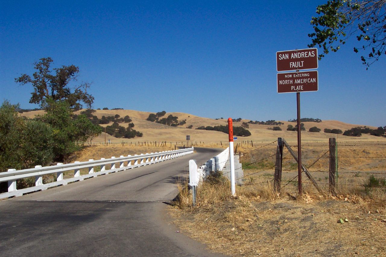 Just south of Parkfield, I stopped at the bridge where every tourist stops, the bridge slightly contorted by the slow creep of the San Andreas fault. One side of the bridge is the Pacific plate and the other is the North American plate. Whichever side you're standing, the opposite side will be moving to your right, assuming you're facing the other side. Therefore, as is well known, the San Andreas fault is a right-lateral strike-slip fault.
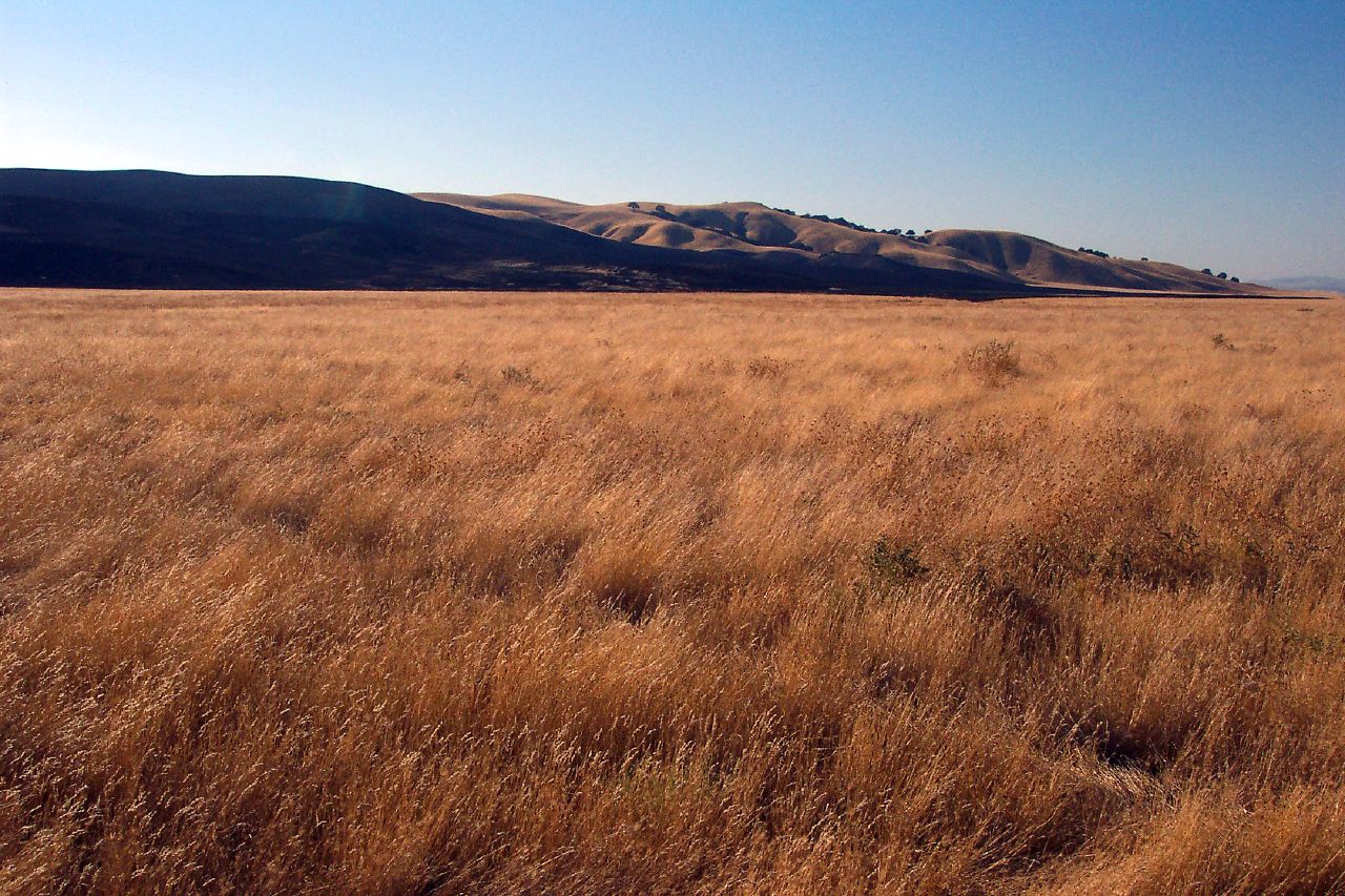 My little country road adventure finally came to an end at the intersection with Highway 46 under the low late afternoon sun at the bottom end of Cholame Valley. I stopped for a couple more snapshots before heading on to Paso Robles for the night. It was very near here where James Dean was killed on September 30, 1955 in a head-on collision at the intersection of Highway 46 and Highway 41. I was 6 months old at the time.

2 comments:
Beautiful photos! Yes, it's the California I think of, rather than what it's become!
Thanks kanani. It's the California I think of, too. Someday I'd like to have winter retirement home somewhere here in the central Coast Ranges. Western Washington is unsurpassed in the summer but the winter days are gray with a short span of daylight.
Post a Comment